
![[Aggregator] Downloaded image for imported item #8281](https://echoesofthelastmind.com/wp-content/uploads/2026/08/dailymotion-xaxzbuu.webp)
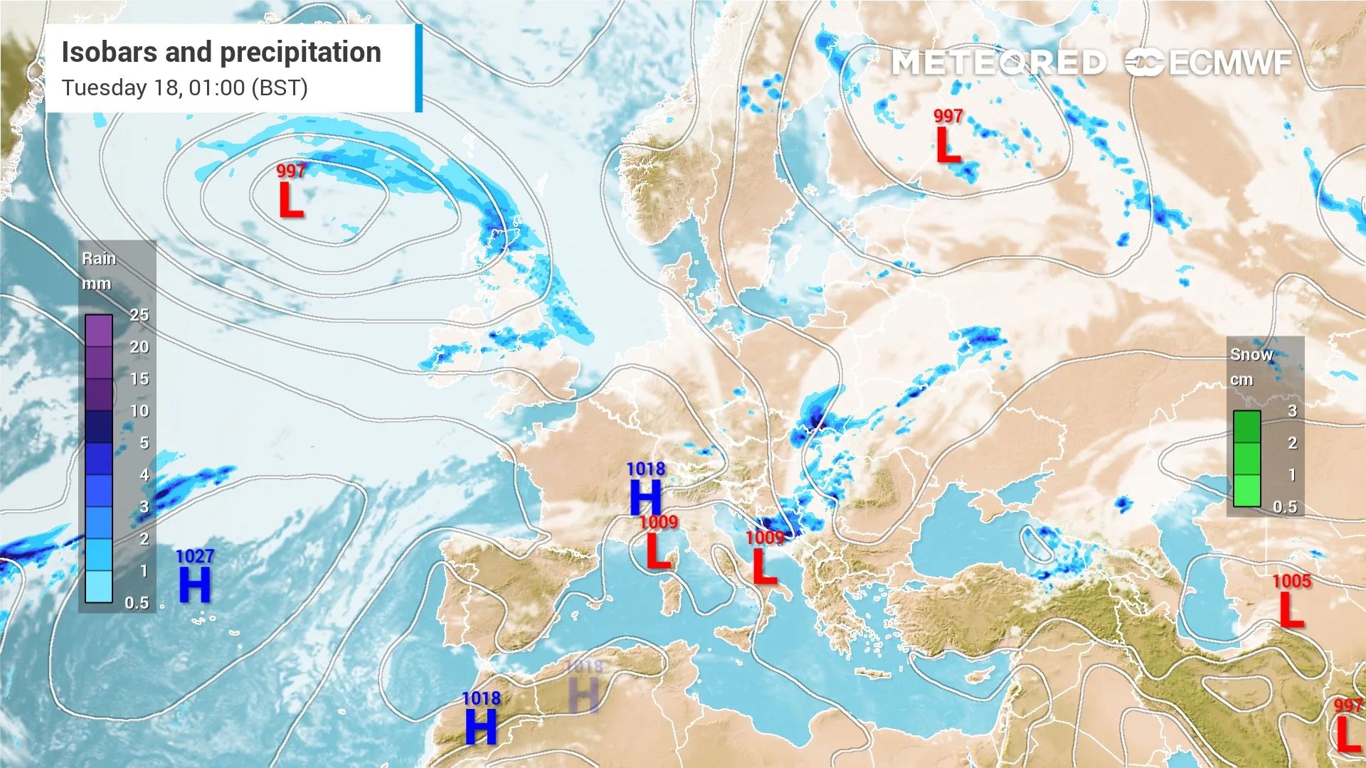 The high pressure that has kept the south dry for weeks will finally collapse this week as a 997 hPa Low sweeps across the UK. London will see 4.1mm of rain by Wednesday, with Plymouth recording 7.5mm. Inverness will lead the totals with 27.6mm. Is this the end of the drought? A
fter an intense but short heatwave, the UK will finally have its typical summer weather — whether you like it or not. But I bet you will appreciate it more after struggling to sleep through those warm nights.T
he video shows two lows in the Atlantic that will bring rain to the UK. The upper low will be responsible for Sunday’s rain in Scotland and some drops in the Midlands, but it will dilute by the end of the day. T
he more significant low, located further south and full of active fronts, will begin moving closer to the UK as the high pressure retreats to Spain. This low will reach Scotland on Monday afternoon, with a massive rain shield spreading across southern areas by Tuesday midnight.S
 cotland will fish for rain and catch most of it, as usual.T
he Wet Cavalry Arrives in the South
On Monday, a deeper 999 hPa Low will track northwest of Scotland, driving significant rain into Belfast 7.6mm and western Scotland (11.5mm in Glasgow) and going beyond south (map below). B
y Tuesday, the cold front will push southeast into Northern and Central England, delivering peak daily rainfall to Manchester (6.6mm) and York (4.2mm) while initiating cooling across
Original Record.
This archived record authored by ‘Felipe Tornquist’ at ‘METEORED (Your Weather)’ was recovered from data set:
 English