
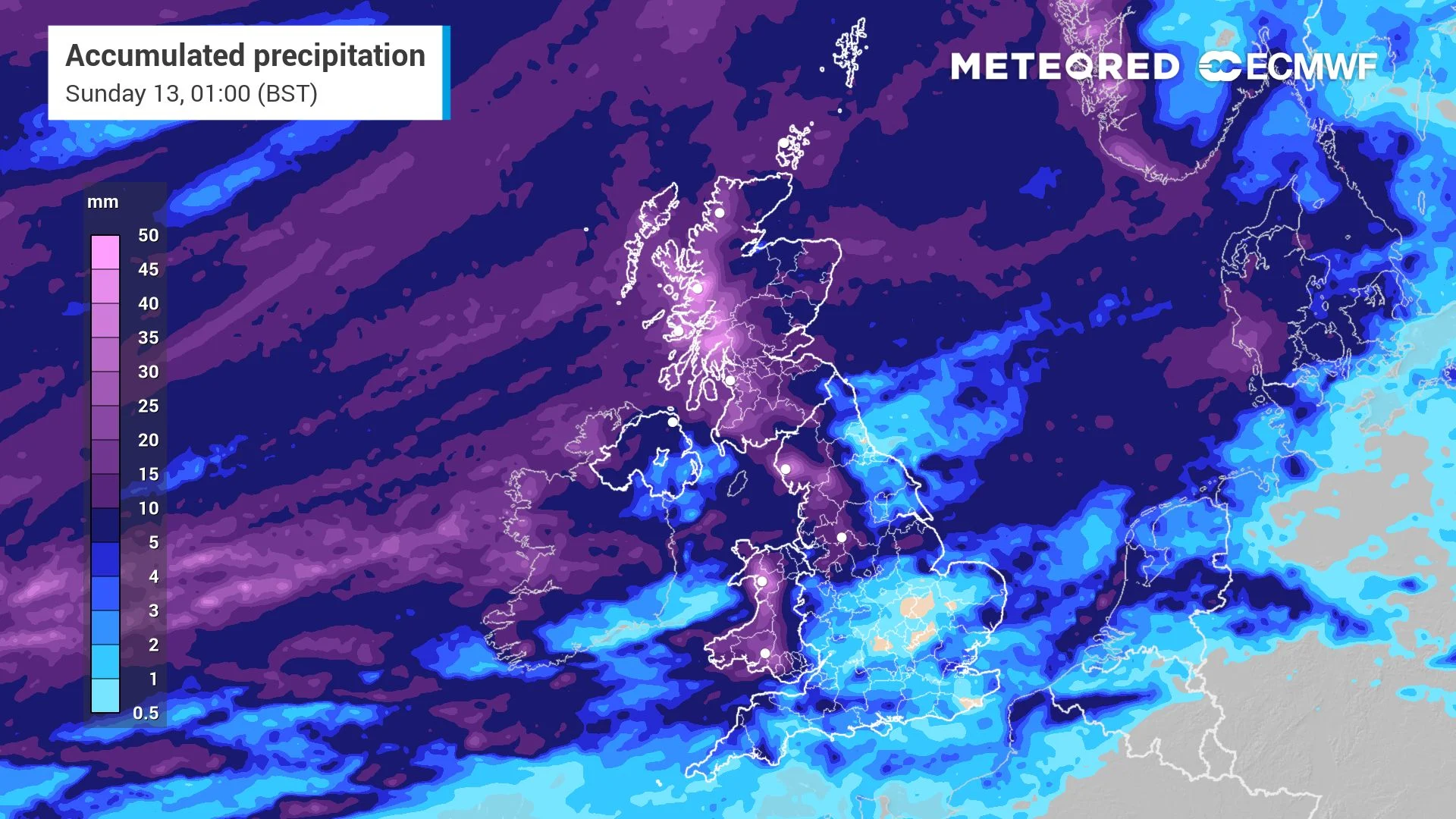
 A tale of two halves will unfold this week as Atlantic lows battle a European high. Glasgow will take 15.8mm on Saturday, while London reaches 24°C by Monday. Friday offers a brief interlude before the north-south divide sharpens. Will the south hold onto the warmth?
As mentioned above, an active weather pattern will dominate the United Kingdom this weekend. A tug-of-war between Atlantic low-pressure systems pushing from the west and a resilient high-pressure block over Western Europe will create a sharp north-south divide.
Where northern and western regions face heavy rain and strong winds (see video above), southern areas will stay drier and experience a late-season heat spike by early next week. Let’s break down the story now.
Friday offers a brief interlude across most regions as a decaying low clears eastward, allowing a weak high-pressure ridge to build from the southwest.
Light, scattered showers will linger mostly in eastern areas, leaving the majority of the UK with a fine, quiet day. But something is coming the next day (map below).
 The widespread isobars over the south mark the European high that will divert the low directly towards Faroe Islands on Saturday.
Temperatures will sit at a mild 21°C in London, Brighton, Birmingham, Norwich, and Dundee, while Manchester, Belfast, and Edinburgh hold at 17°C, and Glasgow stays at 16°C. Peak rainfall remains minimal, topping out at just 2.6mm in Manchester.
A Tale of Two Halves as Atlantic Lows Battle European High
By Saturday, the powerful Atlantic low teased in the map above will
Original Record.
This archived record authored by ‘Felipe Tornquist’ at ‘METEORED (Your Weather)’ was recovered from data set:
 English